Overlanding is often about traveling beyond the places where conventional roadside assistance, cellular networks, and other everyday services are readily available. A route that looks manageable on a map can quickly become a serious emergency when a vehicle breaks down, someone is injured, severe weather arrives, or the group becomes separated. In these situations, reliable emergency communication can be just as important as recovery equipment, navigation tools, food, water, and first-aid supplies.
The farther an overlanding route gets from towns and major roads, the more important it becomes to have a way to request help. A vehicle may be immobilized by a mechanical failure, damaged suspension, flat tires, flooding, or an accident. An injury can also turn an otherwise routine trail into a situation requiring outside assistance.
Remote travel introduces another problem: distance from people who can respond. Even if you know your exact location, telling someone where you are is difficult when there is no cellular coverage.
An emergency beacon or satellite communicator provides another layer of communication that does not depend on a nearby cell tower. Depending on the device, it can either send a dedicated distress alert to search-and-rescue authorities or provide two-way satellite communication with an emergency response center.
For serious backcountry travel, this distinction matters. A 406 MHz Personal Locator Beacon (PLB) is specifically designed to transmit a distress alert through the international Cospas-Sarsat search-and-rescue system. Satellite messengers, meanwhile, can provide interactive SOS communication and ordinary two-way messaging through their service provider.
Smartphones are extremely useful for overlanding, but they should not be treated as a complete emergency communication system.
A smartphone normally depends on cellular networks for calls, texts, and internet-based communication. Once you travel beyond cellular coverage, those functions may become unavailable. Even when a phone displays a GPS position, that does not automatically mean it can transmit that position to rescuers.
This is an important distinction:
GPS determines where you are; communication technology determines whether someone else can receive that information.
A phone can calculate its location using GNSS signals without having cellular service, but that location may remain on the device if there is no available communication method.
Satellite-enabled smartphones can provide additional emergency capabilities in supported locations, but dedicated satellite communicators and PLBs remain valuable because they are specifically designed around off-grid communication or distress signaling. Dedicated devices can also provide physical controls, dedicated antennas, longer operational endurance, or specialized SOS functions depending on the model.
Emergency beacons are designed to provide a communication path when conventional cellular service is unavailable.
There are two major approaches used by modern overlanders.
A 406 MHz PLB transmits a distress signal to the Cospas-Sarsat satellite-aided search-and-rescue system. The transmission contains a unique beacon identifier, and compatible beacons can also provide location information using GNSS. Cospas-Sarsat satellites and ground infrastructure process distress signals and pass alert information to the appropriate authorities for response.
A two-way satellite messenger uses a commercial satellite communication network and service to exchange messages. Depending on the device and plan, users can send and receive text messages, share their location, track their journey, and initiate an interactive SOS. Garmin’s current inReach ecosystem, for example, supports two-way messaging and interactive SOS through its response coordination service.
This means an overlander can potentially communicate important information even after leaving cellular coverage.
An ordinary GPS navigator primarily helps you navigate. It may show maps, routes, coordinates, trails, waypoints, and your current position, but navigation capability alone does not mean the device can send an emergency alert.
An emergency beacon has a different purpose.
A 406 MHz PLB is designed specifically to transmit a distress signal to the search-and-rescue system. A satellite messenger combines satellite communication with features such as messaging, tracking, location sharing, and SOS.
In simple terms:
- GPS navigator: helps you determine where to go.
- PLB: sends a dedicated distress alert when you need emergency assistance.
- Satellite messenger: provides communication and SOS capability beyond cellular coverage.
Some modern devices combine navigation and satellite communication, but buyers should still examine the actual communication technology rather than assuming every GPS device provides emergency communication.
What Are Overlanding Emergency Beacons?
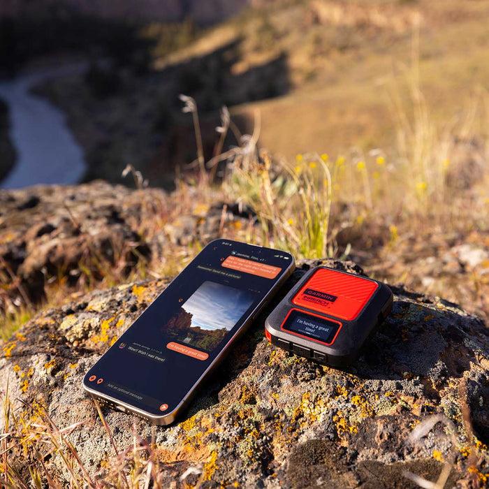
An overlanding emergency beacon is a communication or distress-signaling device intended to help travelers request assistance when normal communication methods are unavailable or unreliable.
The term can describe several different technologies, so it is important not to treat every satellite-capable device as the same type of emergency beacon.
The most important distinction is between a 406 MHz Personal Locator Beacon and a two-way satellite communicator.
A PLB is a dedicated distress beacon that operates through the international Cospas-Sarsat system. When activated, a 406 MHz beacon transmits a distress signal containing identification information, and compatible units can transmit GNSS-derived location data. Cospas-Sarsat infrastructure detects and processes these alerts before they are passed to appropriate search-and-rescue authorities.
A satellite messenger works differently. It communicates through a commercial satellite network and service provider. Its capabilities can include two-way text messaging, location sharing, tracking, check-ins, and an interactive SOS service.
How Emergency Beacons Communicate a Distress Signal
A 406 MHz PLB sends a digital distress transmission when the user activates it.
The signal contains a unique identifier, commonly referred to as a HEX ID or beacon identification code. NOAA explains that the embedded identifier can identify the beacon and, when the beacon is registered, provide information that can help search-and-rescue personnel determine an appropriate response.
Modern 406 MHz distress beacons can also incorporate GNSS positioning. This allows the distress message to include location information, which can significantly assist search-and-rescue operations.
The signal is received through the Cospas-Sarsat satellite-aided search-and-rescue infrastructure. Ground systems process the alert and determine how it should be routed to the responsible authorities.
Satellite messengers follow a different process. The SOS request is transmitted through the device’s satellite network to the provider’s emergency response service. For example, Garmin says that an inReach SOS connects the user with Garmin Response, where response personnel can communicate with the user, gather information, and coordinate assistance.
Why Satellite-Based Emergency Communication Is Valuable in Remote Areas
Cellular networks are designed around terrestrial infrastructure such as towers and backhaul connections. Remote deserts, mountains, forests, and long-distance trails can have little or no cellular coverage.
Satellite communication provides a fundamentally different path.
Instead of depending on a nearby cellular tower, a satellite communicator or beacon can transmit toward satellites when the device has a suitable view of the sky. This is particularly useful for overlanders traveling far from populated areas.
However, satellite communication does not mean the device will work perfectly under every condition. Terrain, dense vegetation, canyon walls, vehicle structures, and other obstructions can interfere with the device’s ability to establish or maintain a satellite connection.
For this reason, users should understand where their device’s antenna is located and, when practical, move to an area with a clearer view of the sky before attempting non-immediate communications.
Emergency Beacon vs. GPS Navigator
These devices may appear similar because both can determine or display a user’s location, but their primary purposes are different.
| Device | Primary purpose | Sends emergency alert? | Two-way communication? |
|---|---|---|---|
| GPS navigator | Navigation and positioning | Usually no | Usually no |
| 406 MHz PLB | Emergency distress signaling | Yes | Generally no |
| Satellite messenger | Communication + SOS | Yes | Yes |
| Vehicle tracker | Vehicle location/tracking | Depends on system | Depends on system |
A GPS receiver can determine your coordinates without transmitting them. A PLB is designed to transmit a distress alert. A satellite messenger can transmit location and other information and receive responses.
Therefore, buying a GPS navigator should not automatically be considered equivalent to buying an emergency communication device.
Emergency Beacon vs. Two-Way Satellite Communicator
The terminology can become confusing because satellite messengers are sometimes marketed as emergency beacons or SOS devices.
A PLB is primarily an emergency distress device. Its 406 MHz transmission is designed for the Cospas-Sarsat search-and-rescue system. It generally does not provide the routine two-way messaging experience available from a satellite messenger.
A two-way satellite communicator is designed for broader communication. Depending on the model and subscription, it can allow users to:
- Send text messages
- Receive replies
- Share their location
- Send check-in messages
- Track their journey
- Communicate during an emergency
- Exchange information with an emergency response service
Garmin’s current inReach products, for example, provide two-way satellite messaging and interactive SOS capabilities when supported by an active service plan.
For an overlander who wants both routine communication and emergency capability, a satellite messenger may therefore be more versatile. For someone who wants a simple, dedicated distress device without routine messaging, a PLB can be more appropriate.
Emergency Beacon vs. Vehicle Tracking Device
A vehicle tracking device primarily answers the question: Where is the vehicle?
Depending on the system, it may periodically transmit the vehicle’s location to a monitoring platform, fleet manager, owner, or other authorized user.
That is different from a personal emergency beacon.
A vehicle tracker may remain attached to the vehicle while the overlander is hiking, exploring, recovering a vehicle, or moving away from camp. If the person encounters an emergency away from the vehicle, the tracker may not help them communicate.
This is why vehicle-based communication should generally complement rather than replace a personal emergency device.
For remote overlanding, a personal beacon or satellite communicator should be accessible to the people who may actually need to activate it—not permanently buried inside the vehicle.
How SOS Signals Reach Search-and-Rescue Organizations
The exact pathway depends on the technology.
With a 406 MHz PLB, activation causes the beacon to transmit a distress signal through the Cospas-Sarsat system. The satellite and ground infrastructure processes the alert and provides the information to the appropriate search-and-rescue authorities.
With a commercial satellite messenger, the SOS normally goes to the device provider’s emergency response service. The response team can communicate with the user and coordinate with the appropriate emergency authorities. Garmin, for example, describes its inReach SOS process as an interactive system in which response personnel can gather information and coordinate a rescue response.
This difference is important when comparing products. A PLB is not simply a satellite messenger with fewer features, and a satellite messenger is not simply a GPS with an SOS button. Their communication architectures and emergency-response pathways are different.
How Emergency Beacons Work
Satellite Networks and Distress Signals
A 406 MHz PLB transmits a digital distress signal that can be detected by the Cospas-Sarsat satellite-aided search-and-rescue system. The system uses satellite and ground infrastructure to detect and locate distress beacons and forward alert information for response.
Commercial satellite messengers use their own satellite communications infrastructure and service arrangements. The exact satellites, coverage characteristics, messaging behavior, and emergency-response process depend on the manufacturer and service provider.
This is one reason buyers should look beyond the phrase “global satellite coverage” and investigate the actual network, supported countries, service requirements, and operating limitations.
GPS/GNSS Location Information
A satellite beacon can use GNSS positioning to determine the user’s location.
GPS is part of the broader GNSS family. Depending on the device, positioning may use GPS alone or multiple satellite navigation systems.
For emergency use, location information can be extremely valuable because a distress alert tells rescuers that help is needed, while accurate coordinates help them determine where to send assistance.
A device’s ability to obtain a position and its ability to transmit that position are separate functions, however. The device must successfully communicate the information through its relevant satellite or distress-alert system.
406 MHz Distress Signaling
The 406 MHz frequency is internationally designated for distress alerting. NOAA explains that ELTs, EPIRBs, and PLBs transmit distress signals on 406 MHz, and the signal includes a unique digital identifier known as the HEX ID.
This is a key characteristic of a true 406 MHz PLB.
A PLB should therefore not be confused with a general-purpose GPS tracker or a satellite messaging device simply because all of them may display coordinates or use satellites.
Search-and-Rescue Coordination
The beacon itself does not perform the entire rescue.
It is the first part of a larger system. Once a distress alert is detected and processed, the relevant authorities determine how to respond based on the location, available information, local procedures, and circumstances.
A satellite messenger can add another layer because the user may be able to communicate with an emergency response center after initiating SOS. This can allow responders to obtain additional details about injuries, vehicle condition, hazards, access routes, and other circumstances.
Why Clear Satellite Visibility Matters
Satellite communication generally works best when the device has a clear view of the sky.
A vehicle roof, dense forest canopy, steep canyon walls, cliffs, or buildings can obstruct the antenna’s view and make communication more difficult.
This does not mean a satellite device is useless in challenging terrain. Rather, it means users should understand that satellite communication is not identical to cellular communication and should position the device appropriately whenever circumstances allow.
For immediate life-threatening emergencies, users should follow the manufacturer’s SOS procedure rather than delaying an alert simply to obtain ideal conditions.
What Happens After You Press SOS?
Pressing SOS should never be treated as pressing a button that automatically guarantees an immediate rescue.
The exact process depends on the device.
Device Activation
The first step is activation of the device’s SOS function. Manufacturers commonly use deliberate button sequences or protective covers to reduce accidental activations.
Users should learn the exact procedure before traveling because an emergency is a poor time to study the manual.
Location Transmission
The device attempts to provide its location through its applicable communication system.
For a GNSS-equipped 406 MHz beacon, location information can be incorporated into the distress alert. For satellite messengers, the device can transmit location information to the emergency response service when communication is established.
Emergency Response Center Notification
A satellite messenger’s SOS can reach the provider’s emergency response organization. In Garmin’s case, inReach SOS alerts are handled through Garmin Response, where response personnel can communicate with the user and coordinate assistance.
A 406 MHz PLB follows the Cospas-Sarsat alerting pathway toward the appropriate search-and-rescue authorities.
Communication With Rescuers
This is where the difference between a PLB and a satellite messenger becomes particularly important.
A conventional PLB is primarily a distress-alerting device and generally does not provide the same interactive messaging capability as a two-way satellite communicator.
A two-way satellite messenger can allow the emergency response service to ask questions and receive answers. Additional information can help responders understand the situation and determine the appropriate response. Garmin describes this interactive process as part of its inReach SOS system.
Search-and-Rescue Coordination
After the alert is received, the responsible emergency organization determines how assistance should be coordinated.
The response may depend on the user’s location, the nature of the emergency, weather, terrain, available rescue resources, local procedures, and the information available to responders.
An SOS alert does not guarantee immediate physical rescue.
The device establishes an emergency communication pathway; it does not control the availability or arrival time of rescue teams.
For this reason, overlanders should continue to use sound trip planning, navigation, vehicle preparation, first-aid skills, emergency supplies, and route-sharing practices alongside their emergency communication equipment.
Types of Emergency Beacons for Overlanding
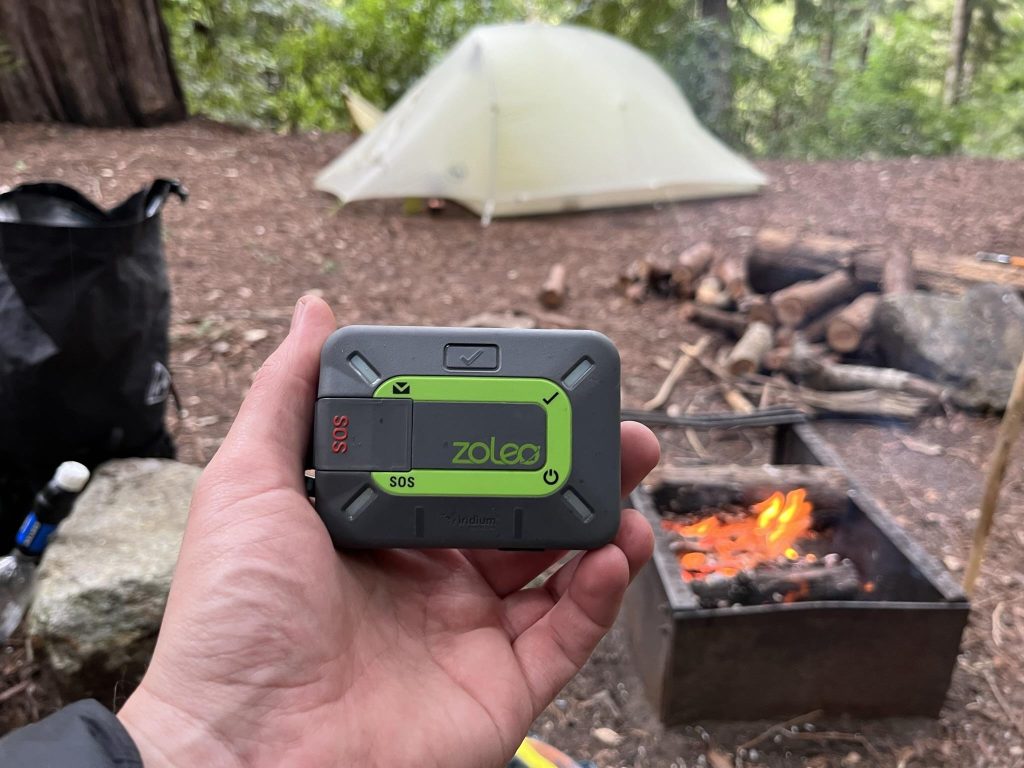
There is no single device that is ideal for every overlander. Emergency communication equipment ranges from dedicated 406 MHz PLBs to sophisticated two-way satellite communicators and satellite-enabled smartphones.
The right choice depends on whether the primary requirement is dedicated distress signaling, routine off-grid communication, vehicle tracking, or a combination of these capabilities.
Personal Locator Beacons (PLBs)
A Personal Locator Beacon (PLB) is a compact emergency device designed primarily to send a distress alert through the 406 MHz Cospas-Sarsat search-and-rescue system.
For overlanders traveling in isolated areas, a PLB can provide a dedicated emergency communication layer that does not depend on cellular service.
What a PLB Is
A PLB is intended to be carried by an individual and activated when that person is in a serious emergency requiring assistance.
Unlike a conventional GPS receiver, the PLB is specifically designed to transmit a distress signal.
NOAA describes 406 MHz distress beacons as devices whose primary function is to alert search-and-rescue authorities when a person is in trouble and needs help.
406 MHz Distress Transmission
When activated, the PLB transmits a digital distress signal on the internationally designated 406 MHz distress frequency.
The transmission contains a unique beacon identification code. When the beacon is registered, the associated information can help authorities identify the beacon and improve the response process.
GPS/GNSS Positioning
Many modern PLBs incorporate GNSS positioning capability.
When the device obtains a valid position, that information can be included with the distress alert. A known location can make it significantly easier for responders to determine where assistance is required.
This is especially valuable during overlanding because remote trails can be difficult to describe using road names or conventional addresses.
Direct Connection With Search-and-Rescue Systems
A major advantage of a 406 MHz PLB is its connection to the Cospas-Sarsat satellite-aided search-and-rescue system.
The system is specifically designed to detect and locate distress beacons and forward alert information to authorities responsible for search-and-rescue operations.
This is different from a general satellite messaging service, where an SOS normally passes through the device manufacturer’s commercial response infrastructure.
One-Way vs. Two-Way Communication
Traditional PLBs are primarily one-way distress-alerting devices.
They are excellent at communicating that an emergency exists, but they generally do not provide the ongoing text conversation available from a two-way satellite messenger.
That distinction can be important.
A PLB may be attractive to an overlander who wants a simple emergency backup without needing to send routine messages. A satellite messenger may be more useful to someone who wants to communicate with family, share locations, track a route, and exchange information with an emergency response center.
Advantages of PLBs for Remote Overlanding
PLBs can offer several benefits:
- Dedicated emergency purpose
- 406 MHz distress signaling
- Access to the Cospas-Sarsat SAR system
- No ordinary cellular coverage requirement
- GNSS positioning on equipped models
- No routine messaging subscription for the beacon itself in the same way commercial satellite messengers require service plans
- Simple operation when used according to manufacturer instructions
- Useful as a dedicated backup to other communication equipment
Their simplicity is one of their strongest advantages.
Limitations of PLBs
PLBs also have limitations.
Most importantly, a traditional PLB does not provide the everyday communication capabilities of a satellite messenger. You generally cannot use it to send routine check-in messages, exchange texts with family, or continuously share your trip with friends.
Two-way communication after an SOS is also not the normal operating model for a conventional PLB.
Another consideration is that registration requirements depend on the country and beacon coding. For example, U.S.-coded 406 MHz beacons must be registered with NOAA, and NOAA emphasizes that keeping registration information current helps SAR authorities respond effectively.
When a PLB Makes More Sense Than a Satellite Messenger
A PLB can be a strong choice when your main requirement is emergency-only communication.
It may make sense for an overlander who:
- Travels in extremely remote areas
- Wants a dedicated emergency backup
- Does not need routine satellite messaging
- Wants to avoid a recurring messaging subscription
- Already has another navigation or communication system
- Wants a device primarily designed for distress signaling
For high-isolation trips, some travelers may carry a PLB alongside a satellite messenger rather than choosing between them.
Two-Way Satellite Messengers
A two-way satellite messenger is a communication device that allows users to exchange messages beyond cellular coverage through a satellite network.
This category has become particularly useful for overlanders because it combines routine communication with emergency capabilities.
Current Garmin inReach devices, for example, support two-way satellite messaging and interactive SOS, while compatible products can also provide location sharing and tracking.
Text Messaging Outside Cellular Coverage
Satellite messengers allow users to communicate when conventional cellular networks are unavailable.
Depending on the device and service plan, users can send messages to phones, email addresses, other compatible users, or web-based tracking pages. Garmin’s inReach messaging system, for example, supports private and group messaging through satellite connectivity.
This makes a satellite messenger useful for more than emergencies.
An overlander can send a simple check-in such as “We reached camp safely,” provide a new estimated arrival time, or notify family about a route change without waiting for cellular coverage.
Interactive SOS
One of the most important features is interactive SOS.
Instead of simply transmitting a distress signal and waiting, supported satellite messengers can establish communication between the user and an emergency response center.
Garmin states that its inReach SOS system connects users with Garmin Response, where response personnel can pinpoint the incident location, gather additional information through two-way messaging, coordinate the response, and communicate with emergency contacts.
This can be particularly valuable when the nature of the emergency needs explanation.
Location Sharing
Location sharing allows an overlander to provide their current position to family, friends, or other authorized contacts.
This can also be useful for group travel when vehicles become separated.
Location sharing should not be confused with emergency signaling. A person can share a location without being in distress, while an SOS is an emergency request requiring an appropriate response.
Tracking
Many satellite messengers support periodic location tracking.
Tracking can create a record of an overland route and allow selected contacts to follow the trip remotely.
However, tracking consumes more battery than leaving a device idle, so travelers should understand how their selected tracking interval affects operating time.
Check-In Messages
Check-in messages are useful for routine safety communication.
An overlander can establish a schedule such as:
- Leaving the trailhead
- Reaching a remote campsite
- Beginning a difficult section
- Arriving at a planned waypoint
- Completing the day’s travel
Regular check-ins can reassure people at home without generating unnecessary emergency alerts.
Communication With Family or an Overlanding Group
Two-way satellite messaging is particularly valuable when traveling with multiple vehicles.
If a convoy becomes separated, a satellite messenger can provide another communication channel when cellular service disappears.
It can also allow an overlander to tell family members about delays, route changes, mechanical problems, or changes to the planned itinerary.
Emergency-Response-Center Communication
The two-way nature of a satellite messenger can become especially important after activating SOS.
The emergency response center may need information about the user’s condition, number of people involved, location details, hazards, vehicle access, or other circumstances.
Because the user can respond to questions, the emergency team can obtain information rather than relying exclusively on the initial SOS transmission. Garmin specifically identifies this interactive communication as part of its inReach SOS process.
Subscription Requirements
Unlike a basic GPS receiver, most commercial satellite messengers require an active service plan for satellite messaging and SOS functions.
The exact pricing, plan structure, activation rules, suspension options, message allowances, and tracking costs vary by provider and country.
For example, Garmin’s inReach ecosystem requires a satellite subscription for its two-way messaging and related satellite services.
Therefore, the purchase price of the device should not be the only factor considered. Overlanders should calculate the total cost of ownership, including the subscription over the period they expect to use the device.
Satellite SOS Devices
Some products focus more narrowly on satellite-based emergency assistance rather than providing the broad feature set of a full satellite messenger.
These devices can appeal to minimalist travelers who mainly want an SOS capability without needing extensive messaging, mapping, or tracking functions.
Their major advantage is simplicity. A smaller feature set can mean fewer functions to learn and potentially less complexity during an emergency.
The limitation is equally straightforward: a minimalist SOS device may not provide the routine communication, tracking, or two-way messaging available from a full satellite communicator.
Before purchasing, verify exactly what the device can do without a cellular connection, whether SOS is interactive, what network it uses, whether a subscription is required, and where the service is supported.
Vehicle-Based Emergency Communication
Vehicle-based satellite communication systems can provide useful communication capabilities from an overlanding vehicle.
They may be particularly valuable for expedition vehicles, fleet operations, or travelers who spend most of their time inside a vehicle.
However, vehicle-based equipment should not automatically replace a personal emergency device.
An overlander may need to leave the vehicle to inspect a damaged route, help another vehicle, collect water, hike to a campsite, or seek a safer position. If the emergency occurs away from the vehicle, equipment mounted inside or permanently attached to the vehicle may not be accessible.
For this reason, a practical setup is often layered:
Vehicle communication + personal satellite device + navigation + backup power.
The personal device should remain accessible and should ideally be carried whenever the traveler leaves the vehicle in remote terrain.
Smartphone Emergency Satellite Features
Modern smartphones are increasingly capable of communicating through satellites in supported regions and on supported models.
These features can be extremely useful because travelers already carry smartphones and can use familiar interfaces.
However, smartphone satellite capabilities vary considerably by:
- Phone model
- Operating-system version
- Country or region
- Carrier
- Satellite service
- Available feature
- Sky visibility
- Battery level
A smartphone with satellite emergency functionality should therefore not automatically be considered equivalent to a dedicated satellite messenger or 406 MHz PLB.
Dedicated devices may offer physical SOS controls, specialized antennas, rugged construction, longer battery endurance, tracking features, or communication functions specifically designed for outdoor use.
For serious remote overlanding, the strongest approach is often to treat smartphone satellite capability as one layer of redundancy, rather than the only emergency communication method.
In other words, your phone can be an important tool, but a dedicated emergency device can provide additional protection when traveling far beyond cellular coverage.
Key Features to Look for in Overlanding Emergency Beacons
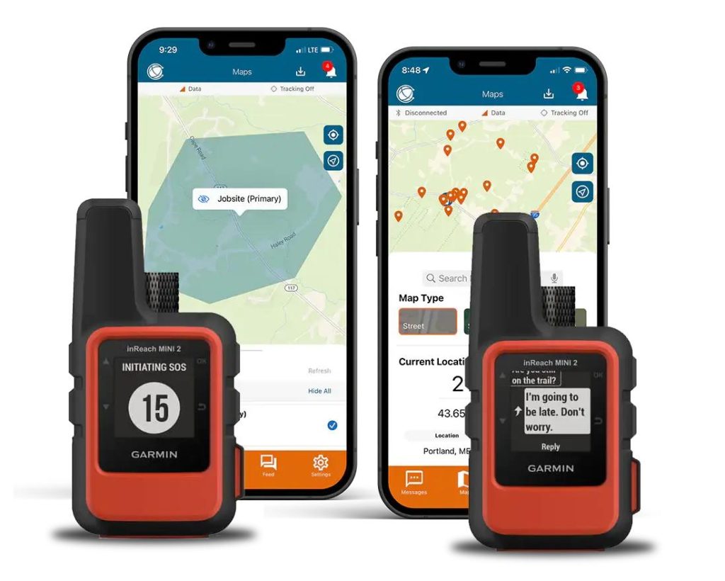
Choosing an emergency beacon for overlanding is not simply about buying the device with the longest advertised battery life or the most features. The right equipment needs to match the environment, the type of communication you need, and the consequences of losing connectivity.
A dedicated 406 MHz PLB and a two-way satellite messenger can both provide emergency capability, but they accomplish it differently. A PLB is designed primarily to alert search-and-rescue authorities through the Cospas-Sarsat system, while a satellite messenger can provide interactive communication, tracking, location sharing, and other satellite services.
When comparing overlanding emergency beacons, pay particular attention to the following features.
SOS Function
The SOS function is the most important feature to understand because it may be used when you are injured, stranded, lost, or dealing with a serious vehicle emergency.
A good emergency device should make SOS activation deliberate but straightforward.
Look for:
- A clearly identifiable SOS control
- Protection against accidental activation
- Easy operation when wearing gloves
- A visible or audible activation confirmation
- Clear instructions for cancelling a false alert
- Confirmation that the alert was received when the technology supports it
With 406 MHz beacons, activation immediately generates a distress transmission, which is why users should never experiment with the SOS button casually. NOAA specifically warns that inadvertent activation can generate a false alert and recommends following the manufacturer’s testing procedures.
Some newer 406 MHz beacons also support Return Link Service (RLS). RLS can provide an indication that the distress signal has been received and localized and forwarded to government authorities. Importantly, RLS does not mean that rescuers have already been dispatched or that physical rescue is underway.
Satellite messengers can provide another advantage: interactive SOS. Instead of simply transmitting an emergency alert, compatible systems can allow the emergency response center to communicate with the user.
For example, Garmin’s current inReach service provides interactive SOS through Garmin Response, allowing response personnel to exchange information with the person requesting help.
Satellite Network Coverage
Satellite coverage is one of the most important specifications for an overlanding emergency beacon.
However, “global coverage” should not be interpreted as “the device will work anywhere under every condition.”
Satellite communication depends on factors such as:
- The satellite network being used
- Service availability in the country or region
- Device antenna performance
- View of the sky
- Terrain
- Vegetation
- Buildings or vehicle structures
- Weather and environmental conditions
- Device orientation and placement
For example, Garmin states that its inReach service uses the global Iridium satellite network for two-way messaging, weather and tracking functions.
A 406 MHz PLB uses a different system. Cospas-Sarsat is an international satellite-aided search-and-rescue system specifically designed to detect distress beacons. Its satellite infrastructure includes low-Earth-orbit, geostationary and medium-Earth-orbit components.
This difference matters when comparing devices.
A satellite messenger’s commercial network and a 406 MHz PLB’s search-and-rescue network should not be treated as interchangeable.
Mountains, Forests and Canyons
Physical surroundings can affect satellite communication.
A device operating in an open desert with an unobstructed sky may have an easier time communicating than one positioned deep inside a narrow canyon or under dense forest.
When circumstances allow, place the device where it has the clearest practical view of the sky. Avoid burying it inside a glovebox, backpack, metal storage box, or other location that can interfere with its antenna.
In an actual life-threatening emergency, however, users should follow the manufacturer’s SOS procedure rather than unnecessarily delaying an alert while searching for a perfect location.
Two-Way Communication
Two-way communication is one of the biggest advantages of a satellite messenger over a traditional PLB.
A conventional PLB is primarily designed to send a distress alert. A two-way satellite communicator can allow you to send and receive information.
This can be useful for:
- Emergency communication
- Family updates
- Group coordination
- Route changes
- Check-in messages
- Weather information
- Location sharing
- Communication with an emergency response center
During a rescue, two-way communication can be particularly valuable because the situation may change after the initial SOS.
For example, responders may need to know:
- How many people are involved
- Whether anyone is injured
- Whether the vehicle is accessible
- Whether there are immediate hazards
- Whether the group has shelter
- Whether the user’s location has changed
- Whether additional information can help identify an access route
Garmin’s inReach SOS service is specifically designed around this interactive model, with Garmin Response personnel able to communicate with the user and coordinate the response.
A PLB can therefore be preferable when simplicity and dedicated distress signaling are the priority, while a satellite messenger can be more versatile for travelers who want communication before, during and after an emergency.
GPS/GNSS Location Accuracy
Location information is fundamental to remote rescue.
A distress message that says help is required is useful. A distress message that also provides accurate coordinates is much more actionable.
Many modern PLBs include GNSS receivers that can provide location information with the distress signal. NOAA notes that GNSS-equipped 406 MHz PLBs can significantly improve location accuracy.
Satellite messengers can similarly transmit location information and may provide additional tracking and location-sharing capabilities.
When evaluating a device, consider whether it provides:
- Current location coordinates
- GNSS positioning
- Location sharing
- Breadcrumb tracking
- Periodic tracking
- Location transmission during SOS
- Mapping or navigation integration
It is also useful to distinguish positioning accuracy from communication reliability.
A device can determine your coordinates accurately but still have difficulty transmitting them if its antenna has poor satellite visibility.
Battery Life
Battery performance becomes especially important when you are away from electrical infrastructure for several days.
Manufacturers usually advertise battery performance under specific operating conditions, so don’t assume the maximum advertised runtime will apply to every trip.
Battery consumption can increase significantly when using:
- Frequent tracking
- Continuous location updates
- Two-way messaging
- Navigation
- Bluetooth connections
- Weather requests
- Live tracking
- Frequent screen use
A device sitting idle may last much longer than the same device transmitting its location every few minutes.
For overlanding, consider both standby battery life and active-use battery life.
You should also consider:
- USB-C or proprietary charging
- Charging from the vehicle
- Power-bank compatibility
- Spare cables
- Solar charging options
- Cold-weather battery performance
- Battery condition after long storage
A satellite beacon is only useful when it has enough power to transmit.
Durability and Weather Resistance
Overlanding equipment can experience vibration, dust, rain, mud, extreme temperatures and repeated impacts.
An emergency device should therefore be rugged enough for the environments in which you intend to use it.
Look for specifications covering:
- Water resistance
- Dust resistance
- Shock resistance
- Operating temperature
- Storage temperature
- Drop resistance
- Construction quality
Don’t assume that a device described as “rugged” automatically has the same protection as a professional expedition device.
Check the manufacturer’s actual IP rating and environmental specifications.
For vehicle travel, also consider where the device will be stored. A beacon left in a hot vehicle can experience temperatures very different from those in a controlled indoor environment.
Ease of Use
Emergency equipment should be easy to operate when you are tired, cold, injured or under pressure.
This is why simplicity can be more important than having the longest feature list.
Consider:
- Physical SOS controls
- Screen visibility in bright sunlight
- Backlighting at night
- Glove-friendly buttons
- Menu simplicity
- Smartphone integration
- Audible or visual alerts
- Emergency operation without a phone
A device that requires several complicated steps through a smartphone application may not be ideal if the phone is damaged, out of battery, or inaccessible.
For critical functions, physical controls can provide an important layer of redundancy.
Subscription and Operating Costs
The purchase price is only part of the cost of a satellite communicator.
Depending on the service, you may need to pay for:
- Monthly subscription
- Annual subscription
- Activation
- Messaging
- Tracking
- Weather requests
- Premium features
- Service suspension or reactivation
Garmin’s current consumer inReach service, for example, requires an active plan to use satellite features such as SOS, two-way messaging and live tracking. Garmin’s current plans include different levels of messaging and tracking, with plan structures subject to change.
This means buyers should calculate the expected total cost of ownership, rather than comparing only the upfront device prices.
A PLB has a different cost structure because it is primarily a dedicated distress beacon rather than a subscription-based messaging platform. However, users still need to account for battery replacement, registration where required, and eventual device replacement.
PLB vs Satellite Messenger: Which Is Better for Overlanding?
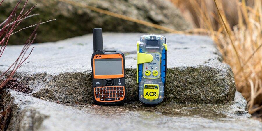
There is no universal winner between a Personal Locator Beacon and a satellite messenger.
The better choice depends on what you expect your emergency communication equipment to do.
A PLB is primarily an emergency distress device, while a satellite messenger combines emergency assistance with everyday satellite communication.
For remote overlanding, understanding this distinction is more useful than simply asking which device is “best.”
| Feature | PLB | Satellite Messenger |
|---|---|---|
| Primary purpose | Emergency distress alert | Communication + emergency response |
| SOS | Yes | Yes |
| 406 MHz distress signaling | Yes | Generally no |
| Two-way messaging | Generally no | Yes |
| Location sharing | Emergency-focused | Yes |
| Routine tracking | Limited or unavailable | Usually available |
| Routine messaging | No | Yes |
| Subscription | Typically no messaging subscription | Usually required |
| Search-and-rescue alert | Through Cospas-Sarsat | Through provider’s response service |
| Family communication | No | Yes |
| Group communication | No | Yes |
| Best suited to | Dedicated emergency backup | Communication + SOS |
The key technical difference is the emergency signaling pathway.
A 406 MHz PLB transmits through the Cospas-Sarsat search-and-rescue system, which is specifically designed to detect distress beacons and route alerts to the appropriate authorities.
A satellite messenger uses its commercial satellite network and service provider. Current Garmin inReach plans, for example, provide two-way messaging and interactive SOS through Garmin Response.
When a PLB Is the Better Choice
A PLB may be the better option if your priority is dedicated emergency signaling rather than everyday communication.
It can make sense when you:
- Travel in very remote areas
- Regularly venture far from roads
- Want a dedicated emergency backup
- Do not need routine satellite messaging
- Do not want a recurring messaging subscription
- Already have another navigation system
- Prefer simple emergency equipment
- Want a device specifically designed around 406 MHz distress signaling
The simplicity of a PLB can be an advantage.
You do not need to manage a messaging conversation, compose routine check-ins, or maintain a data plan simply to keep the basic distress function available.
However, you must understand its limitations. A conventional PLB does not give you the same interactive communication capability as a satellite messenger.
For example, after activation you generally cannot have a text conversation with rescuers explaining that you have a broken leg, three people are involved, the vehicle is blocking a trail, and the safest approach is from a particular direction.
That is where a two-way communicator can provide additional value.
When a Satellite Messenger Is Better
A satellite messenger is generally more useful for overlanders who spend significant amounts of time outside cellular coverage and want communication as well as emergency capability.
It can be a particularly good fit for:
- Frequent off-grid travelers
- Solo overlanders
- Long-distance expeditions
- Family travelers
- Convoys
- International overlanding
- People who want routine check-ins
- Travelers who want location tracking
- Users who want two-way SOS communication
For example, a solo traveler can use a satellite messenger to send a check-in when reaching camp, share their location with family, monitor a route, and communicate with an emergency response center if something goes wrong.
This broader functionality makes satellite messengers more versatile than dedicated PLBs.
The tradeoff is greater complexity and an ongoing service cost.
You also need to keep the subscription active if you want to use the provider’s satellite features. Garmin’s current inReach documentation confirms that an active subscription is required for satellite features such as SOS, two-way messaging and tracking.
Why Some Overlanders Carry Both
For serious remote expeditions, the question does not always have to be PLB or satellite messenger.
Some overlanders may reasonably choose both.
The idea is redundancy.
A satellite messenger can handle everyday communication and provide interactive SOS. A PLB can serve as a dedicated 406 MHz emergency backup.
For example:
Satellite messenger
→ Routine communication
→ Tracking
→ Location sharing
→ Check-ins
→ Interactive SOS
PLB
→ Dedicated distress signaling
→ Cospas-Sarsat alert pathway
→ Independent emergency backup
Carrying both can make sense when the consequences of losing your primary communication method are particularly serious.
It is especially worth considering for:
- Solo expeditions
- Very remote desert travel
- Long-distance wilderness routes
- High-isolation international trips
- Extended trips far from roads
- Situations where communication redundancy is a priority
The important principle is that redundancy should involve different layers, not simply multiple copies of the same device.
For example, carrying two satellite messengers that depend on the same service may not provide as much diversity as carrying a satellite messenger plus a 406 MHz PLB.
How to Choose the Best Emergency Beacon for Your Overlanding Trips
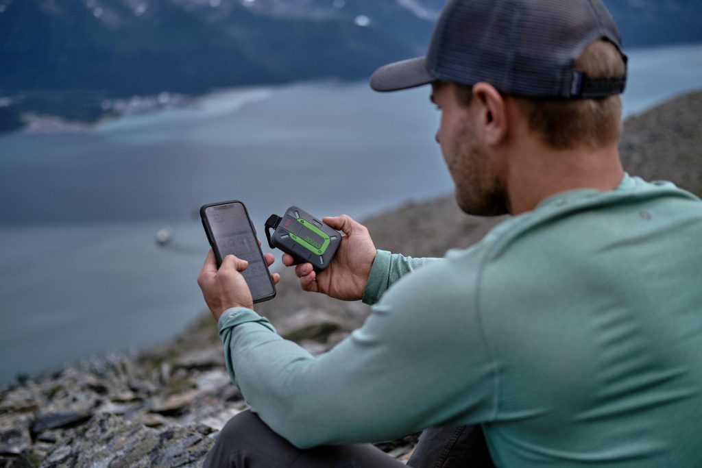
The best emergency beacon is the one that matches your actual travel conditions and communication requirements.
There is no universal device that is ideal for every overlander.
Someone who takes occasional weekend trips close to towns may have very different requirements from someone who spends weeks traveling through remote deserts or mountain regions.
Use the following framework to narrow down your options.
Consider Your Travel Environment
Start by looking at where you actually travel.
Ask:
How far am I normally from reliable cellular coverage and emergency services?
If most of your trips remain close to populated areas, a smartphone plus conventional emergency equipment may cover many situations.
As isolation increases, the value of satellite communication also increases.
Remote Deserts
Desert routes can involve enormous distances between settlements and limited cellular infrastructure.
A satellite communicator or PLB can provide an important emergency communication layer when mechanical failures, heat exposure, dehydration, injuries or navigation problems occur far from assistance.
Mountains
Mountain environments introduce another challenge: terrain obstruction.
Steep slopes, cliffs and deep valleys can make satellite communication more difficult because the device may not have a clear view of the sky.
If you frequently travel through mountainous terrain, prioritize a device that is easy to reposition and use outside the vehicle when necessary.
Forest Trails
Dense forest can interfere with satellite visibility.
If you frequently travel under heavy canopy, consider equipment that can be positioned where the antenna has the best practical view of the sky.
Do not assume that a device labeled “global” will communicate equally well from every location.
Long-Distance Expeditions
Long expeditions increase the importance of:
- Battery endurance
- Charging redundancy
- Subscription planning
- Tracking
- Weather information
- Routine communication
- Emergency response
- Device durability
A satellite messenger can be particularly attractive for these trips because it can provide both everyday communication and SOS functionality.
International Overlanding
International travelers need to pay additional attention to service availability and beacon registration.
Do not assume that the registration requirements of one country apply everywhere.
For example, U.S.-coded 406 MHz beacons are registered through NOAA in the United States, while NOAA specifically directs owners of non-U.S.-coded beacons to the appropriate national authority associated with the beacon’s country code.
Before crossing borders, verify:
- Satellite service availability
- Device compatibility
- Local regulations
- Beacon registration requirements
- Emergency contact procedures
- Subscription availability
- Regional restrictions
Consider How Often You Travel Off-Grid
Your frequency of use should influence the type of equipment you buy.
Occasional Weekend Trips
If you only occasionally travel beyond cellular coverage, a dedicated PLB can be attractive because its primary emergency function does not require you to maintain a regular messaging service.
A satellite messenger can still make sense if you want tracking and routine communication during those trips.
Frequent Overlanding
If you are regularly outside cellular coverage, a satellite messenger becomes more compelling.
You may use it for:
- Daily check-ins
- Location sharing
- Route tracking
- Weather information
- Family communication
- Group coordination
- Emergency assistance
The more often you use these functions, the easier it is to justify the recurring service cost.
Long Expeditions
For multi-week or multi-month trips, battery management, charging and subscription planning become much more important.
Consider carrying:
- Vehicle charging
- Power bank
- Spare charging cable
- Solar charging where appropriate
- Backup communication equipment
A satellite device should be incorporated into your overall power-management plan rather than treated as an isolated gadget.
Full-Time Travel
Full-time overlanders may benefit from a satellite messenger because communication becomes a regular requirement rather than an occasional emergency function.
A two-way device can become part of the normal travel workflow for communicating with family, tracking routes, receiving weather information and coordinating with other travelers.
A PLB can still serve as an additional emergency layer for those who want maximum redundancy.
Consider Whether You Travel Alone or in a Group
The number of people traveling with you changes your communication needs.
Solo Travelers
Solo overlanders have a particularly strong reason to carry reliable emergency communication.
If something happens to you, there may be no one else available to activate a device or explain the situation.
A two-way satellite messenger can be especially useful because it provides routine check-ins and interactive SOS capability.
A PLB can provide another layer of protection.
Couples and Families
For couples and families, consider whether everyone knows where the emergency device is and how to activate it.
A device that only one person understands is less useful if that person becomes incapacitated.
The entire group should know:
- Where the device is stored
- How to activate SOS
- How to cancel a false alert
- How to send a check-in
- How to identify the device’s current location
Convoys and Group Expeditions
Groups can benefit from satellite messaging because vehicles may become separated.
A satellite messenger can provide another way to coordinate:
- Meeting points
- Route changes
- Delays
- Vehicle problems
- Camp locations
- Emergency situations
However, each vehicle should not assume that another vehicle will always be close enough to help.
Each vehicle or traveler should have an appropriate emergency plan.
Consider Your Communication Needs
Your desired communication level is one of the easiest ways to decide between a PLB and satellite messenger.
Emergency-Only
If you only want a device for a serious emergency, a PLB may be sufficient.
Check-Ins
If you want to tell family members that you have safely reached camp or a waypoint, a satellite messenger is more useful.
Two-Way Messaging
If you want to receive replies while outside cellular coverage, you need a device and service that supports two-way satellite messaging.
Location Tracking
If family or friends need to follow your progress, choose a device with satellite tracking and location-sharing capabilities.
Weather Information
Some satellite messengers can request weather information through their satellite service. Garmin’s current inReach plans, for example, include weather-related features depending on the plan selected.
Weather capability can be particularly useful when overlanding in remote regions where conventional internet access is unavailable.
However, weather information should supplement—not replace—proper trip planning and local weather awareness.
Group Coordination
For convoy travel, messaging and location sharing can be significantly more useful than a distress-only device.
A satellite messenger therefore becomes more attractive when communication is a routine part of the trip.
Consider Total Cost of Ownership
Don’t compare devices only by their purchase price.
Calculate the cost over the period you expect to own the equipment.
Consider:
Initial cost
- Device
- Protective case
- Mount
- Accessories
Recurring costs
- Satellite subscription
- Messaging
- Tracking
- Weather
- Premium services
Maintenance costs
- Battery replacement
- Device replacement
- Charging cables
- Backup power
Garmin’s current consumer inReach structure demonstrates why this matters: its satellite features require a service plan, while plan levels determine included messaging and other capabilities.
A lower-priced device can therefore become more expensive over several years if its service fees are high.
Conversely, a more expensive device may provide better value if you use its satellite functions frequently.
Recommended Decision Framework
Use this simple decision framework before buying.
Choose a PLB if:
- You mainly want an emergency distress signal
- You travel in very remote locations
- You do not need routine satellite messaging
- You want to avoid a recurring communication subscription
- You want a dedicated emergency backup
- You prefer a simple emergency device
- You want access to the 406 MHz Cospas-Sarsat distress-alerting system
A PLB is especially compelling when your primary concern is getting a distress alert to search-and-rescue authorities rather than maintaining everyday communication.
Choose a Satellite Messenger if:
- You frequently travel outside cellular coverage
- You want regular off-grid communication
- You need location tracking
- You want to share your location with family
- You want two-way messaging
- You want interactive SOS communication
- You travel solo
- You want weather information while off-grid
- You regularly coordinate with other overlanders
This option provides significantly more functionality but normally comes with an ongoing service cost.
Consider Carrying Both if:
- You regularly undertake high-isolation expeditions
- You travel alone
- You operate far from roads or population centers
- You travel for extended periods
- You want independent emergency communication layers
- Redundancy is a major priority
The strongest emergency setup is rarely based on one gadget.
A robust overlanding communication system might combine:
Cellular phone + satellite messenger + PLB + navigation device + paper maps + multiple charging methods.
Each layer addresses a different failure point.
If cellular service disappears, the satellite messenger can provide communication.
If the satellite messenger fails or becomes unavailable, a PLB can provide a dedicated distress-alerting path.
If electronic navigation fails, offline maps and paper maps provide another backup.
That layered approach is particularly valuable when traveling far enough that help may take hours or days to reach you.
How to Use an Emergency Beacon Safely While Overlanding
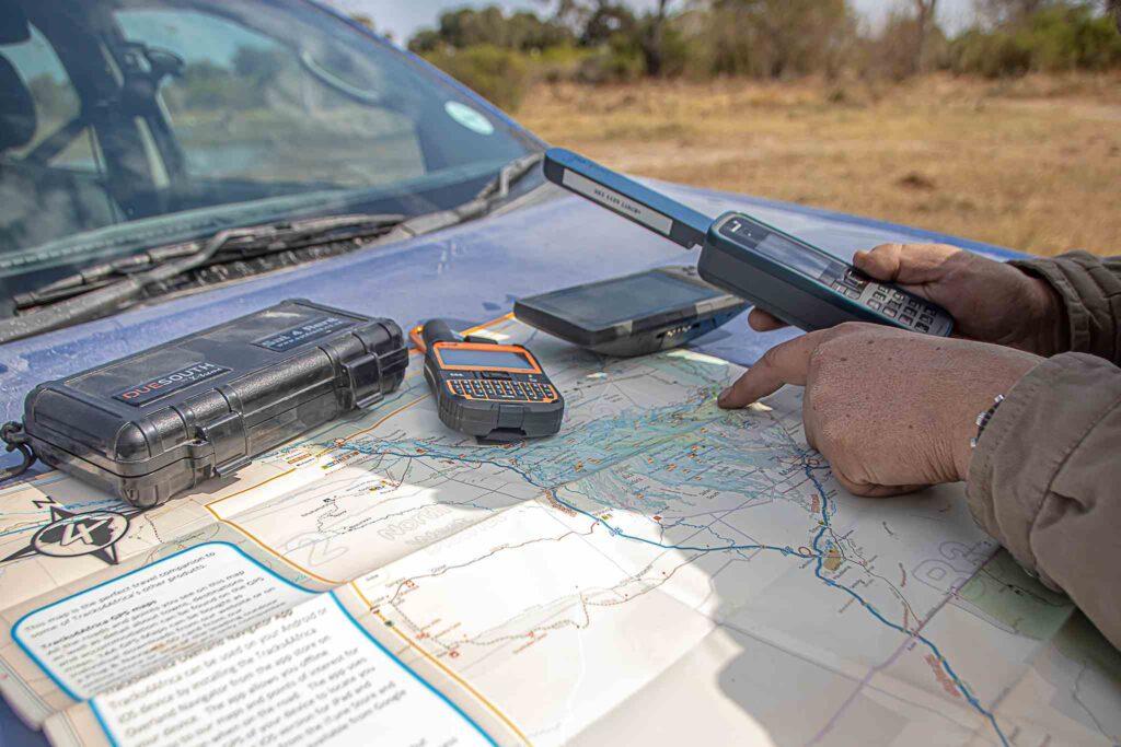
Buying an emergency beacon is only the first step. A device is useful in a real emergency only if it is registered when required, adequately charged, accessible, understood by everyone in the group, and used according to the manufacturer’s instructions.
This is particularly important with 406 MHz PLBs because activating the device generally generates a genuine distress alert. NOAA explains that 406 MHz beacons should not be casually activated or “tested” outside the approved self-test procedure.
Register Your Beacon When Required
Registration is an important part of using a 406 MHz beacon responsibly.
For example, U.S.-coded 406 MHz beacons must be registered with NOAA, and the registration information should be kept current. NOAA explains that the beacon’s unique identification number is associated with the owner’s registration information, allowing search-and-rescue authorities to identify the beacon and obtain useful information when an alert is received.
Registration requirements are not necessarily identical worldwide. If you purchase or operate a beacon coded for another country, follow the registration requirements of the appropriate national authority.
When registering, make sure information such as the following is accurate:
- Beacon identification/HEX ID
- Owner information
- Telephone number
- Emergency contacts
- Relevant trip or vessel/vehicle information where applicable
- Other information requested by the national registration authority
If your phone number, address, emergency contact, or ownership changes, update the registration.
For U.S.-coded beacons, NOAA currently states that registration is valid for two years and must be renewed.
Registration does not replace the need for a properly functioning beacon. Instead, it gives SAR authorities additional information that can help identify the person or vehicle associated with an activated beacon.
Learn the SOS Procedure Before Your Trip
Don’t wait until an accident happens to learn how your emergency device works.
Before leaving, read the manufacturer’s instructions and understand:
- Where the SOS control is located
- How to activate SOS
- Whether the control has a protective cover
- How the device confirms activation
- How to communicate after SOS activation
- How to cancel an accidental alert
- How the device’s self-test works
- What the device’s status indicators mean
This is particularly important because emergency situations can involve stress, darkness, cold, injury, or limited visibility.
NOAA recommends becoming familiar with a 406 beacon before an emergency and following the manufacturer’s instructions for testing.
Also make sure everyone traveling with you knows where the device is and understands the basic SOS procedure.
Keep the Device Accessible
An emergency beacon should not be treated like spare equipment that can remain buried at the bottom of a storage box.
Keep it somewhere that can be reached quickly.
Good locations may include:
- A driver’s accessible storage area
- A center console
- A dedicated emergency-gear pouch
- A backpack carried when hiking away from the vehicle
- A secure location inside the cabin where passengers can reach it
Avoid putting a personal beacon deep inside luggage or storing it somewhere that becomes inaccessible if the vehicle is damaged.
This becomes especially important if you leave the vehicle.
If you hike several kilometers away from your overland rig and encounter an emergency, the vehicle-mounted communication equipment cannot help you if you cannot reach it.
For personal safety, a portable PLB or satellite messenger should generally be carried on your person whenever you leave the vehicle in remote terrain.
Also consider satellite visibility. When practical, position a satellite device where it has a clear view of the sky rather than leaving it inside a metal container, closed vehicle compartment, or other obstructed location.
Maintain Battery Power
Battery management is one of the easiest things to overlook.
Before every remote trip:
- Fully charge rechargeable devices
- Check the battery indicator
- Inspect charging cables
- Confirm your power bank works
- Carry an appropriate vehicle charging solution
- Consider a second charging method for long expeditions
- Understand how tracking affects battery consumption
A satellite messenger transmitting location information frequently can consume substantially more power than a device that remains mostly idle.
For long trips, create a simple charging routine rather than waiting until the battery becomes critically low.
Your vehicle’s electrical system can be the primary charging source, but a power bank or other backup can provide an additional layer if the vehicle battery fails.
Test the Device Correctly
Never press the real SOS button simply to see whether it works.
For 406 MHz beacons, NOAA explains that the manufacturer’s self-test mode is designed to verify the beacon without generating a normal distress alert. Activating an operational beacon outside the approved testing process can be interpreted as a real emergency and may unnecessarily trigger search-and-rescue activity.
Follow the manufacturer’s specified self-test procedure.
Satellite messengers have their own testing procedures. For example, Garmin currently requires users to request and schedule an SOS test with Garmin Response rather than simply activating the live SOS function. Garmin says test requests should be submitted at least 72 hours before the requested test, and an active subscription is required for the SOS test.
This distinction is important:
Self-test ≠ live SOS.
Before a trip, verify the device using its approved testing procedure, confirm that the battery is healthy, and make sure the subscription or registration requirements are satisfied.
Create an Emergency Communication Plan
An emergency beacon works best as part of a larger emergency plan.
Before leaving, tell a trusted person:
- Your planned route
- Starting location
- Major destinations
- Expected return date
- Approximate arrival times
- Planned campsites where appropriate
- Vehicle description
- Number of travelers
- Emergency contact details
For longer expeditions, establish regular check-in intervals.
For example, you might agree that a contact will hear from you each evening. If a check-in is missed, that person knows when to become concerned and what route information is available.
A satellite messenger can make these check-ins much easier because it can transmit messages and location information beyond cellular coverage.
However, an emergency beacon should not replace responsible trip planning. Someone on the outside should still know where you intend to travel and when you are expected to return.
Best Practices and Common Mistakes With Overlanding Emergency Beacons
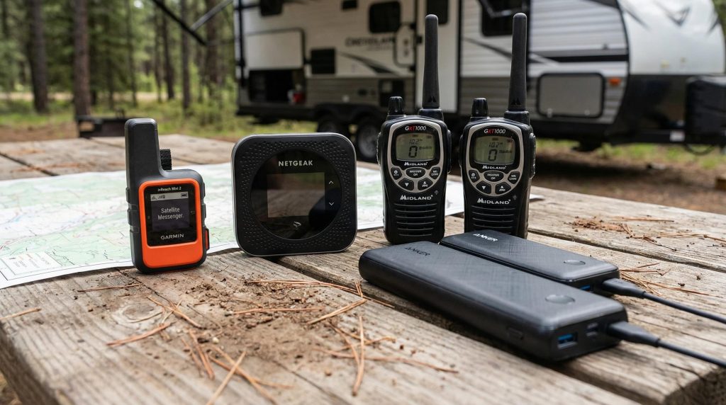
An emergency beacon should be part of a broader overlanding safety system rather than treated as a magic rescue button.
The best results come from combining reliable communication equipment with route planning, navigation, vehicle preparation, emergency supplies, power redundancy, and basic first-aid knowledge.
Best Practices
Carry the Device on Your Person When Away From the Vehicle
If you leave the vehicle to hike, inspect a trail, recover another vehicle, or explore a remote area, take your personal emergency communicator with you.
A beacon locked inside the vehicle provides little protection if the emergency occurs several kilometers away.
Keep It Charged
Make battery checks part of your departure routine.
For rechargeable satellite communicators, charge the device before leaving and carry backup power for longer trips.
For PLBs, follow the manufacturer’s battery replacement and maintenance requirements rather than assuming the battery will last indefinitely.
Register It Where Required
If your beacon requires registration, complete it before your trip.
For U.S.-coded 406 MHz beacons, NOAA requires registration and recommends keeping the information current.
Registration information can help authorities identify the beacon and determine who may be associated with an alert.
Update Emergency Contacts
An outdated emergency contact can reduce the usefulness of your registration or trip plan.
Review your emergency contacts before major expeditions, especially if your normal travel partners have changed.
Check Satellite Coverage and Service Availability
Before traveling internationally or into particularly remote areas, verify that your device’s satellite service is supported where you intend to use it.
Also check whether the device requires an active subscription.
For example, Garmin’s current inReach system uses the Iridium satellite network and requires an active satellite subscription for its satellite communication functions.
Carry Backup Communication and Power Equipment
A robust overlanding setup can include several layers:
- Cellular smartphone
- Satellite messenger
- 406 MHz PLB
- Vehicle radio
- Offline navigation
- Paper maps
- Vehicle charging
- Power bank
You don’t necessarily need every item, but the farther you travel from assistance, the more valuable redundancy becomes.
Learn the SOS Procedure
Every traveler should know the basic emergency procedure before the trip.
Don’t assume that someone else knows how to operate the device.
Combine Technology With Proper Trip Planning
Satellite communication should complement—not replace—good preparation.
Check weather conditions, understand the route, carry enough water and food, inspect the vehicle, and tell someone where you are going.
A beacon is your emergency communication layer, not your entire emergency plan.
Common Mistakes to Avoid
Relying Entirely on a Smartphone
A smartphone is useful, but cellular coverage can disappear quickly in remote terrain.
Even when a phone can determine its location using GNSS, that does not necessarily mean it can communicate that location to rescuers.
Assuming GPS Automatically Provides Emergency Communication
GPS/GNSS and satellite communication are different functions.
A GPS receiver can determine your location without transmitting it anywhere.
An emergency communicator must have an appropriate communication pathway to send that information.
Buying a Device Without Checking Subscription Requirements
The initial device price does not tell you the complete cost.
Before buying a satellite messenger, check:
- Subscription cost
- Activation fees
- Message allowances
- Tracking charges
- Weather features
- Suspension rules
- Cancellation policies
- International availability
Leaving the Beacon Buried in the Vehicle
An emergency device is most useful when you can reach it immediately.
Don’t store it beneath recovery equipment, camping boxes, clothing bags, or other gear that may become inaccessible after an accident.
Forgetting to Charge It
A sophisticated satellite communicator with a dead battery is effectively useless.
Include the beacon in your pre-trip battery checklist.
Failing to Register a 406 MHz Beacon Where Required
For U.S.-coded 406 MHz beacons, registration is required by law. NOAA emphasizes that registration information helps SAR authorities respond more efficiently.
For other countries, follow the applicable national registration requirements.
Testing SOS by Accidentally Sending a Real Emergency Alert
This is one of the most serious mistakes.
NOAA states that an activation outside the approved self-test procedure can be interpreted as a genuine distress signal.
Likewise, Garmin warns that users should not test the live SOS function without arranging the appropriate test procedure because emergency services or contacts could be notified.
Assuming an SOS Guarantees Immediate Rescue
An SOS establishes an emergency alert and response process. It does not guarantee that a rescue team will arrive immediately.
Terrain, weather, distance, available resources, injuries, access routes, and local SAR procedures can all affect response time.
Garmin also notes that SOS coverage does not necessarily cover the actual costs associated with a rescue.
Traveling Without Telling Anyone Your Route
Even the best satellite beacon should be backed up by an external trip plan.
Someone should know where you intend to go and when you expect to return.
Why Redundancy Matters in Remote Overlanding
Remote overlanding involves multiple potential points of failure.
Your phone can lose cellular coverage. Your vehicle battery can fail. A satellite device can become damaged. A navigation device can run out of power. A route can become impassable.
Redundancy reduces the consequences of any single failure.
A practical layered system might look like this:
Cellular phone
→ Primary communication when coverage exists
Satellite messenger
→ Two-way communication, tracking and interactive SOS beyond cellular coverage
406 MHz PLB
→ Dedicated distress signaling through Cospas-Sarsat
Navigation device
→ Digital navigation and GNSS positioning
Paper maps and compass
→ Navigation backup if electronic systems fail
Multiple charging methods
→ Protection against power loss
The value of redundancy is particularly high for solo travelers and people operating far from roads, settlements, or reliable emergency services.
A satellite messenger and PLB can also provide complementary safety layers because they use different emergency communication approaches.
The objective isn’t to carry as many gadgets as possible. It is to ensure that one equipment failure does not eliminate your only way to communicate an emergency.
Frequently Asked Questions About Overlanding Emergency Beacons
What are the best overlanding emergency beacons?
There is no single best emergency beacon for every overlander.
A 406 MHz PLB is generally better suited to someone who primarily wants a dedicated distress-alerting device connected to the Cospas-Sarsat search-and-rescue system. A two-way satellite messenger is better suited to travelers who want messaging, location sharing, tracking and interactive SOS.
For high-isolation expeditions, carrying both can provide additional redundancy.
Do I need an emergency beacon for overlanding?
It becomes increasingly valuable when you regularly travel beyond cellular coverage, far from roads, or into areas where emergency assistance may take significant time to reach you.
The need is particularly strong for:
- Solo overlanding
- Remote desert travel
- Mountain expeditions
- Long-distance trips
- Extended off-grid travel
- Areas with unreliable cellular service
If you stay close to populated areas and reliable communications, your needs may be different.
What is the difference between a PLB and a satellite messenger?
A PLB is primarily a dedicated emergency distress beacon. Modern 406 MHz PLBs transmit through the Cospas-Sarsat search-and-rescue system and may include GNSS positioning.
A satellite messenger provides broader communication capabilities, including two-way messaging, location sharing, tracking and interactive SOS, depending on the device and service.
In short:
PLB = dedicated distress signaling
Satellite messenger = two-way communication + SOS + additional satellite features
Does an emergency beacon work without cell service?
Yes, satellite-based emergency devices are specifically valuable because they can operate independently of terrestrial cellular networks.
A 406 MHz PLB communicates through the Cospas-Sarsat satellite-aided search-and-rescue system. Satellite messengers communicate through their supported commercial satellite networks.
However, the device still needs appropriate satellite visibility and service availability.
Do satellite emergency beacons require a subscription?
It depends on the type of device.
Traditional 406 MHz PLBs generally do not operate like subscription-based satellite messengers.
Commercial satellite messengers commonly require an active service plan for messaging, tracking and SOS functions. For example, Garmin states that an active subscription is required for inReach satellite services.
Always check the manufacturer’s current plan and pricing before purchasing.
How far can an emergency beacon work?
Satellite emergency communication isn’t best understood in terms of a simple terrestrial distance such as “50 miles” or “500 miles.”
The important factors are satellite network coverage, satellite visibility, terrain, antenna performance, device position and service availability.
A satellite device can potentially communicate over enormous distances because the communication path goes through satellites rather than relying on a nearby cellular tower.
Can an emergency beacon track my location?
Some can.
A traditional PLB is primarily an emergency distress device and is not intended to provide routine journey tracking.
Satellite messengers commonly support tracking and periodic location sharing, depending on the device and service plan.
This makes satellite messengers particularly useful for overlanders who want family or expedition members to follow their progress outside cellular coverage.
Do I need to register a PLB?
Registration requirements depend on the country and beacon coding.
For example, U.S.-coded 406 MHz beacons must be registered with NOAA, and NOAA requires owners to keep the registration information current.
Do not assume that U.S. registration rules apply worldwide. If you use a beacon coded for another country, follow the relevant national authority’s requirements.
Can I use a satellite messenger for vehicle emergencies?
Some satellite messenger SOS services can coordinate assistance for vehicle-related problems.
For example, Garmin states that its SOS functionality can be used for situations including vehicle issues and can coordinate appropriate assistance through Garmin Response.
However, roadside assistance and wilderness search and rescue are not necessarily the same service.
If you are stranded deep in an inaccessible area, your situation may require a different response than a conventional roadside breakdown near a public road.
When using SOS, provide the emergency response service with accurate information about your location, vehicle condition, injuries, hazards and access limitations.
Should I carry both a PLB and satellite messenger?
For serious remote expeditions, carrying both can make sense.
A satellite messenger provides everyday communication, tracking and interactive SOS. A PLB provides a separate, dedicated 406 MHz distress-alerting capability.
This can be particularly valuable for:
- Solo expeditions
- Very remote routes
- Long-duration overlanding
- High-isolation environments
- Trips where communication redundancy is critical
The key advantage is layered protection rather than simply having two devices.
If one communication method becomes unavailable, the second may still provide a way to request emergency assistance.
Read More: Best Hard Shell Roof Top Tents for Trucks – 2025 Buyer’s Guide